Monday, August 19, 2013

Straining up Starvation Mountain from Highland Valley Rd & Camino del Aguila

In my spare time I love Google Earthing remote areas of San Diego County, looking for a new scenic (and hopefully very hilly) road to explore with my road bike. A while back I espied a couple of paved road that branch off from Highland Valley Rd up this little-wrote-about peak between Escondido and Ramona. The peak is called Starvation Mountain. I've googled it to death and still don't know whose starvation its name refers to (or when, for that matter).

*Edit to add: Since I posted this entry I've heard from Ms Wendy Barker of the San Pasqual Battlefield State Historic Park about Starvation Mountain:
"Starvation Mountain, aka Mule Hill, aka Battle Hill, is where American forces led by General Kearny were detained by Spanish forces led by General Andres Pico in 1846. The shortage of food led Americans to eat some of their mules. You can learn more about the battle at the San Pasqual Battlefield State Historic Park on route 78."
Starvation Mountain as seen from Del Lago Blvd in Escondido. No cross on top of it or anything.
At any rate, one isn't likely to starve to death there now, as the area is surrounded by private ranches and estates. I had a good look at one particular road that heads up it, Camino del Aguilar, and didn't see any gate from the aerial shot. That made for an inviting exploration target! (I really don't like trespassing on private roads that much). So, last Thursday I caught an early bus up to Del Lago Transit Station in South Escondido and went for a ride: (open pictures in new tab to see in full size)
David Kreitzer Pedestrian Bridge across Lake Hodges.
Of course, I could have gotten off the bus at Rancho Bernardo Transit Center and coast down W Bernardo Dr to Lake Hodges before turning east on Highland Valley Rd, but why miss a chance to cross the lake on the famous pedestrian bridge? At 990 ft long and 12 ft wide, the Kreitzer Bridge is the longest stressed ribbon bridge in the world. It is quite a feat of engineering and offers amazing view of the mountains nearby. Oh, the lake itself is a beautiful sight, of course, even when it is so dry that weeds and trees are growing on lake bed for almost as far as the eyes can see!
East through the farmlands on Highland Valley Rd. Starvation Mtn beckoning up ahead.
Turning left (east) onto W Bernardo Dr/Pomerado Rd was a bit tricky. I used the pedestrian crossing light, though it took some sprinting start to go immediately up the I-15 overpass and out of the way of cars trying to get on the freeway on-ramp. It was a relief to turn left/east onto Highland Valley Rd, where traffic becomes more scarce (though probably faster-moving).

Highland Valley Rd (HVR) pitching up the mountains.
The lower part of Highland Valley Rd (known locally as the HVR) starts with a little downhill to pick up the south side of the San Dieguito River. Road shoulder more or less disappears after the turn off for unpaved Sycamore Creek Rd and the right side of the eastbound lane is often littered with cracks and rocks. The road starts to pitch up and becomes very steep for a couple of twisty stretches, ranging from 8-12% grade. I didn't much like riding there at all because of the traffic, but it is still a much better cycling route between Escondido and Ramona than Hwy 78 to the north is (that one is way more trafficky).
HVR heading east up the hill.
After a mile and a bit of climbing I passed the turn off for Bandy Canyon Rd that connects HVR with Hwy 78. The road is now a rolling false flat, shortly into which I turned right onto Camino del Aguila, a narrow paved road heading up a steep little hump between two huge ranches (this is the 2nd paved lane heading south from HVR after Bandy Canyon Rd, and it does have a street sign).
Camino del Aguila passing thru fish pond.
After cresting the steep hump the road branches right at the Y-intersection and goes straight (steeply) down the other side to a ravine. Watch out for little hard-to-see speed bumps as you pass the little pond on the left.

Climbing up Camino del Aguila on a bicycle is a very painful way of enjoying spectacular mountain scenery!
Climbing up the other side of the ravine was gentle at around 8% grade at first, then the road does a switchback left and from then on it was 10-18% ramps one after another without letting up for the better part of a mile until near the top.

Why suffer up a beautiful steepie like this without stopping to enjoy the view? You might as well!
But, in this part of town; no pain means no view, my friends. And for a spectacular view, spectacular pain is the going price!
Gate to Eagles Crest Rd from Camino del Aguila.
Dirt track up from top of Cam del Aguila to Starvation Mtn Rd.
After much struggling (it didn't help that I was one-handing a lot of the slope photographing and filming my way up 14% ramps) I made it to the end of Camino del Aguila where it turns into dirt for a bit to connect with Eagles Crest Rd, the private paved lane that comes up the mountain from its east side. Eagles Crest Rd is gated at the top here and also at the entrance from a little further east on HVR. I suppose you can just hike-a-bike around the gate. I had other agenda, however, and opted left up this steep dirt track to pick up the top bit of Starvation Mountain Rd to head further up the mountain.
View from a resting spot on Starvation Mountain Rd. Looks like they had cleared two little plateaux for future houses.
The last (and steepest) ramp up Starvation Mountain Rd... Especially capricious after a mile and a bit of 14% average grade climbing!
More suffering ensued. More hideously steep ramps behind switchbacks separated by some short bits of gentle (5-7%) slopes. Then I got to another Y-intersection and opted right for the ramp that leads uphill... It is a monster ramp! Mid-20's % grade for maybe 60 ft as it wraps its way around the final left curve and ends at a huge gate of the highest house on Starvation Mountain.
Gate at top of Starvation Mtn Rd leading to 18096 Starvation Mtn Rd, blocking off the trail to the top of the peak.
View from top of the road.
As high up Starvation Mtn as a road bike could go.
It isn't the just-to-keep-cars-out sort of gate, but a real 8ft tall estate gate that doesn't show on Google Earth yet. So that was the end of the road for me. Not quite to the top of the peak, but the view is still spectacular in almost every direction! Mt Woodson was close by with the radio towers on its top. Double Peak & Mt Whitney peeking out of the cloud layers to the west like two tiny islands. A view to cure much of the muscle and joint pain the steep climbing had extracted from yours truly.


It was now a bit past 9am, though, and the sun was starting to get annoyed with me, so I started my descent. Braver souls can try and ride down that 27% grade slick top ramp, but I only made it halfway down before putting my foot down and walking the rest of the way to the Y-intersection since I don't have disc brake and didn't feel like sliding right off the mountain (doing so would allow me just enough air time to ponder on my one last stupid move before I finally land on something).


Starvation Mountain Rd descending from the top.
I didn't fancy wearing my brakes out descending on Camino del Aguila, so I opted right at the intersection (no road signs up here, you've better memorize how the roads look from Google map before heading up this mountain!) and then left at the next, down Starvation Mountain Rd.

A roadside Christian shrine on Starvation Mountain Rd.
It is a surprisingly green lane, sloping steeply down through orchards, carving itself around the hill. On a straight away I spotted this cross-topped shrine by the side of the road and decided to investigate. Unfortunately it isn't a historical memorial that tells any story about how Starvation Mountain got it name, but just a Christian shrine with a quote from Genesis put up by the local landowners.
Starvation Mountain Rd car gate. Bikes can walk around the side.
A little further down  I ran into a gate! For a couple of horrifying seconds I thought that I had picked the wrong fork on the road, came down a dead end and would now have to climb back up the mountain.... but then I spotted the intercom box on the other side and realized that I was on the 'private' bit of the road and should be able to get back out to HVR if I walk around the barrier. Whew!

HVR between Starvation Mtn Rd & Eagles Crest Rd.
Eagles Crest Rd at HVR.
Rejoining HVR I headed right/east toward Ramona for a little more climbing. After a while I passed Eagles Crest Rd turn off. It's the private paved road that goes up to nearly connect with Camino del Aguilar high on Starvation Mountain. The big gate at the bottom was wide open (though even when closed you can walk around its right side). That's one nasty steep ramp right at the bottom of it, though; not something I'd like to ride down or up it!

Amy Strong 'Mt Woodson' castle.
Hwy 67 descending through the hills overlooking Poway.
The day was turning very hot, so I opted to ride home the quickest way possible and took Archie Moore Rd to catch Hwy 67 into Lakeside, stopping at Mt Woodson Golf Course for cold drinks and snack along the way (there is no other water stop on the route). Hwy 67 downhill south to Lakeside is a horror story that deserves a post of its own, but it was late morning on a workday so traffic volume was not quite as suicidal to cycle with as would be otherwise. The whole ride was only 48 miles long, but that 14% grade mile and a bit on Camino del Aguila and Starvation Mountain Rd took quite a bit out of my legs!

Tuesday, August 13, 2013

What is it like cycling up the south side of Palomar Mountain?

So, what is it like cycling up Palomar Mountain from Hwy 76 and S6 - South Grade Road?
Endless... At least that's what if feels like. The climb isn't steep (it averages only 7.5%), but it is very consistent and very long. From start to finish the slope varies more than 2% at only one 150 yds long stretch, about 5 miles into the 11.5 miles long climb. That false flat on Hwy 76 just before the South Grade Rd turn off is the only break you'll get in the entire climb. Once you make the turn onto South Grade Rd, it's 6.5-8% grade the rest of the way.

Hwy 76 has a bit of shoulder to ride up, but it is pretty narrow and collects a bit of debris. There is almost always some traffic, and it is always high speed (and tends to be trucks, SUV's or trailers). Once you turn onto South Grade Rd (S6), traffic becomes light to non-existence and there is good shoulder to ride on the rest of the way.


It takes me about 110 minutes to climb Palomar from the south side, and only about 22 minutes to descend it (and that's because I'm a careful rider and slow considerably down once I get back onto Hwy 76 and its car traffic). If you haven't cycled up Palomar from the south before, you should... but try to make it on a weekday as South Grade Rd is way too popular a motorcycle road on weekends that it is quite unsafe.

If you are going up it during the warm months (June-Nov), take at least two big bottles of water (at least one bottle should really be water, since you'll be plagued to the edge of sanity by nasty flies whose sole ambition in life is to get at all the salt around your eyes deposited there by your sweat... And nothing like a good rinse of water would persuade the flies to leave your eyes alone for more than a few seconds).

Oak Knolls Campground at the base of South Grade Rd has a store where you can get water, cold drinks and some candy bars. There is no other water stop along the route (the artesian springs at mile 11 is all dried up). Once you top out, though, there is Mother's Kitchen to lunch at, a nice restroom with running water, and Palomar Mountain General Store with cold drinks and candies.

Wednesday, August 7, 2013

CicloSDias is on Sunday Aug 11th: Come Out To Enjoy Car-Free Cycling, Skating, Walking San Diego Streets

Feel like going out for a casual bicycle ride in San Diego but don't want to tango with cars? Come out to the CicloSDias, San Diego's version of the Ciclovia next Sunday in South Park. This is a family-friendly low-speed 5 miles ride on closed-to-cars route from Logan Heights (30th & K) to City Heights (Cherokee Point Elementary School) by way of Golden Hill, South Park & North Park.

CicloSDias 2013 car-free route
You can bike or walk or skate part of or the whole length of the car-free route with friends new and old from 10am - 4pm, at a speed that allows you to see and enjoy the neighborhoods. It's safe and it's a lot of fun!


A lot of people would like to go out riding their bike more, but don't feel safe riding the streets of San Diego without 'proper bicycle structures' like bike lanes or cycle-paths. Well, what better way to convince city officials to put in the necessary structures than to turn up in great number at car-free events like the CicloSDias and show them that better bike-friendly streets is what a whole lot of tax-payers want? The more cyclists there are riding around, the more the city is likely to do something to protect cyclists and the more aware drivers will become of bikes on the streets. You don't even have to donate any money. Just show up and have fun!

Sunday, August 4, 2013

To Drivers: Don't Make Cyclists Pass On Your Right At Intersections

Another car tried to get me to pass him on his right side this morning (he wanted to turn right, but instead of hanging behind the group to make the turn behind us, he chose to pass us and then just hung at the intersection in the middle of the lane and irritably waved at the line of cyclists to pass on his right)...
If you are a driver and have tried doing that; thank you for trying to be nice, but please refrain from this maneuver in the future. It makes things MORE dangerous for the cyclists and not less. It doesn't matter that you see and know that we are there behind and to your right, you are blocking both our view of traffic and the traffic's view of us. There may be cars coming from opposite direction that want to turn left in front of (stopped) you... That left-turning car is the car that will hit us if we pass you on your right side! Don't get mad at the cyclists for refusing to enter that big blind spot on your right. Go ahead and turn right IN FRONT OF us when you see us yield.

Better yet, wait behind the group of cyclists and make the right turn behind us (it may only slow you down for just a few seconds, but at least you wouldn't be putting anyone in danger). If you had already passed many cyclists and are now 'stuck' in the middle, though, if the cyclists wave for you to make the turn in front of them, please GO ON and make the turn. There is a good reason why you should only overtake on the left... (picture yourself getting stuck between a semi-truck and his right turn... You wouldn't want to pass the truck on his right either!).


And to fellow cyclists: If you are riding in the middle of a large group and see a car front and left of you that want to turn right (look for turning signal), it is safer to slow and make room for the car to turn right in front of you (be sure to signal for the riders behind you to follow your deceleration, though) than for him to end up hanging there, stranded between other traffic, you, and the right turn he wants to make ('cause then he'll end up blocking your view of the rest of the intersection along with all the other cars' view of you).

Wednesday, July 31, 2013

Bike Ride Lake Murray - Mt Helix - Mission Trails Loop

It isn't easy finding a good cycling route here in San Diego that isn't by the coast and doesn't involve spending a lot of time riding with cars on major arteries. This 26 miles loop from Lake Murray to Mt Helix, Mission Trails Regional Park and back is a perfect little ride with not a lot of traffic, however.


The ride starts from the main parking lot by the concession stand on the south side of Lake Murray in La Mesa (enter on Kiowa St from Lake Murray Blvd). There is plenty of parking there, a concession stand selling drinks, fishing baits, and even ice-cream, and good public restrooms. Follow the paved cycling/hiking trail that goes around the lake east, then take the first paved narrow ramp off to the right and climb your way up to Baltimore Dr (the ramp is paved but is quite rough and has a short steep pitch at the top). There is a crosswalk there, use it to turn left on Baltimore Dr and then right on El Paso St through a quiet residential neighborhood.


After about 1/2 mile, turn right on Jackson Dr for a nice downhill (it's a wide street with a bike lane, though much of the bike lane is in the door zone of parallel-parked cars, so stay alert). Merge early to the through lane as you approach the intersections with Fletcher Pkwy and with I-8, after which the road gently climbs up to the mesa south of the interstate. Go straight until the road ends and turn left on 
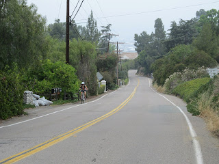
Lemon St (cross traffic doesn't stop here). Once you get past Bancroft, traffic will all but disappear as the road starts to climb up the saddle between Mt Helix and the adjacent (and apparently nameless) hill.

Lemon St is a narrow two-laner with very little to no shoulder. It isn't trafficky, though, and climbs up the hill is sputtering fashions; three steep pitches followed by short downhill sections. The first starts quite gentle and steadily steepens to around 10% approaching the intersection with Alto Dr before dropping off. The next section is a bit more vicious, with a block-long 12% grade ramp that crests at a right hand bend overlooking Lake Helix (you'll have to cross over to the other side of the road to see the charming private lake, however). A short recovery downhill section leads to a short steep pitch up to Fuerte Dr. A quick right turn there followed immediately by another right turn onto Mt Helix Dr takes you away from traffic up the steady 1.5 miles climb to the top.

The straight-ish bit of Mt Helix Dr.
After the grinding straight stretch Mt Helix Dr curves right to climb up around the mountain. If you're suffering as you approach the turn (the road pitches up a bit there), tough it out as the grade becomes markedly more gentle around the bend. Look to your right after you get out of the bushes, too. The view east toward El Cajon, Laguna and Cuyamaca Mountains is usually gorgeous even on overcast days! The road is now a wide one-way street and you'll likely run into more hikers than you will cars. As the road curves left, look up the hill ahead and to the right for the famous rotating house.

Looking ESE from Mt Helix Nature Theater.
Bear right and through an underpass as you make your way up around the mountain as the rock-walled road climbs steadily up. There is plenty of view to look at to take your mind off any hill-induced suffering. The slope steadily shallows after you enter the park gate (the top of the mountain is a private park that is open to the public from sun up to sun down), and before you know it you have topped out at the marvelous stone open-air theater! There is a port-a-toilet by the road and a water fountain in the little open recess by the info board. Mt Helix Nature Theater, the stone auditorium, is worth exploring (it has lots of cool little nooks and corners). There is a paved ramp up to the cross at the top where you can enjoy panoramic view of the area. On a clear day you can see clear to the ocean and even to Palomar Mountain to the north. There is also a cool little hiking trail (Yawkey Trail) around the top of the hill with info boards identifying all the mountain peaks you could see.


After a good rest stop, descend down Mt Helix Dr to the first ring of the road and turn left. Yes, yes, you've been here before, but we're only overlapping just a bit. Take a right onto narrow Alto Dr. This road is very narrow and twisty, but it is a two-way street, so keep right of center and don't speed into its many blind turns (you never know if someone is about to come out of their private drive way!). It was recently re-paved in spring of 2013, and the black asphalt is quite pleasantly smooth. There is a switchback turn and many S-curves as the road winds its way down the slope. Go straight through the intersection with Lemon St until the road ends at Mesa Vista Ave. Shift to low (climbing) gear and turn right and up a vicious little ramp (max gradient is about 17% here) and bear left onto Mesa Terrace.

Turn left on El Granito, then right on Grossmont Blvd and stay on it across to the south side of I-8. Turn right at the intersection and follow Murray Dr east and then north (stay left when it branches into Murray Dr and El Cajon Blvd). Keep right at Dennstedt Pl which then turns into Murray Dr again until it runs into a traffic circle. Exit at S Westwind St and follow it as it winds gently uphill to the intersection with Fletcher Pkwy. Look for a paved little bike path on the right curb between Fletcher Pkwy and Tyrone Ct and turn right onto it. Mind your downhill speed as the pavement is very bumpy (and tree shadows make the bumps hard to see)!

Fletcher Hills bike path. Take the left branch here to exit.
Stay on the path past the two benched look out spots and then take the left fork at the Y-intersection to exit onto Wyatt Pl. Hang a left down the hill and then right on Peltree. Be careful crossing the trolley tracks as you turn right onto N Marshall St. Stay straight through the intersection (and take care to cross the diagonal trolley tracks as perpendicularly as possible) until the road curves left through Gillespie Field to intersect Cuyamaca St (another set of trolley tracks to cross there). You want to be in the through lane to cross the intersection to pick up the paved bike path running on the sidewalk to the right, paralleled to Cuyamaca St, but the traffic light here doesn't pick up bicycles, so you may have to hop onto the sidewalk to hit the pedestrian crossing light. Take the bike path right and follow it as it veers left away from Cuyamaca. Be prepared to stop as it ends abruptly at Prospect Ave. Make the left turn onto Prospect and stay right on the through lane at the first intersection. You're going to hop onto the paved path on the sidewalk parallel to the road and stay on the path as it veers right to pick up a little creek heading north.

After some nice car-free (and very flat) riding the path ends very abruptly on the south side of very busy Mission Gorge Rd. Check the sidewalk for pedestrians and make the sharp right turn, staying on the sidewalk to the next traffic light (there's a pharmacy there) and use the light to turn north onto Carlton Hills Blvd. I'm afraid this is the only 'trafficky' bit of the route. Cross the bridge and merge to the left turning lane as early and safely as you can to turn left on Carlton Oaks Dr. Once you've made the turn the traffic lessens considerably and there is a nice bike lane to ride in. The road ends in a T-intersection with W Hills Pkwy. You want to make a left turn, but may have to use the pedestrian crossing light as the traffic light loop here also doesn't pick up bicycles.

Old Mission Dam in Mission Trails Regional Park. Water & port-a-toilets available.
Turn right onto Mission Gorge Rd (and into headwind) for a short stretch before continuing right onto Junipero Serra Trails through Mission Trails Regional Park. Look out for the Old Mission Dam on the right as the right lane of the road closes to car traffic (the left lane is open to cars, but only runs one-way north). If nature calls, there are port-a-toilets at the Mission Dam parking lot, but if you can hold it another 10 minutes, the park's visitor center at the south end of the trail has a real and clean restrooms with running water!

If you have a bike bell, it would really come in handy riding through Mission Trails park on the Serra Trails as it is a favorite hiking and jogging spots even on weekdays. Please remember that pedestrians always have the right of way on multi-use paths like this (and that you may meet many of the joggers again on the road once they've gotten back in their car).

Junipero Serra Trails through Mission Trails Regional Park.
Turn right at Mission Gorge Rd and carefully merge left on the downhill stretch to turn left onto Jackson Dr. You may have to run the red-light here if no left-turning car materializes to trigger the left turn light for you (yes, another traffic light loop that doesn't recognize bicycles!). This is the last climb of the day and it is a pretty gentle and steady one at about 5-6% grade and about 1.3 miles long (pretty comparable to the climb up Torrey Pines 'Outside'). There is good view of Cowles Mountain to the left as you spin up the hill to the next traffic light. Turn right onto Park Ridge Blvd for a couple of gentle rollers through residential neighborhoods. After the major intersection with Navajo Rd, turn left on Wandermere Dr and down the hill to the stop sign and turn right on Belle Glade Ave and follow it into Lake Murray Park.

Of course, you could also stay on Park Ridge Blvd all the way into Lake Murray Park, but I find its intersection with Murray Park Dr rather dangerous as cross traffic doesn't stop, and any traffic coming from the right comes down a curvy 12% grade slope. Cross traffic as Belle Glade runs into Lake Murray park doesn't stop either, but it is a flat stretch removed from that fast downhill and makes for much more pleasant crossing.

Cycling on Lake Murray multi-use trail.
Stay straight on through the parking lot, down a steep ramp to the lake trail and hang a left... very carefully, please, as the paved multi-use trail is a popular jogging and flat-cycling spot in the area. This is the flat home stretch! Go slow (speed limit is 8 mph) and enjoy the view as you cool down riding the last 2 miles around the lake back to start point on the south side. As on the Serra Trail, pedestrians always have the right of way on Lake Murray path. Please give them plenty of room and call (or ring) out warning before passing them as most will have their ear phone on. Remember, most of these people got here by cars and you'd rather leave them with good impression for the next time you meet on the roads!

I shot a video preview of the ride a while back. Keep in mind that I used a handheld camera, however, so I couldn't shoot on steep up or down slopes (or on the narrow and steep descent of Alto Dr).